


LASO for GAMPS
GAMPS® + LASO® revolutionize emergency response logistics management. On-demand knowledge of available resources, encrypted communications, engagement levels, and situational command dashboards promote intelligent incident response and resiliency.
Innovative and impactful while remaining intuitive and affordable, GAMPS supports crisis management, public safety, and emergency response organizations of any size.
The Geospatial Automated Mission Processing System (GAMPS®) patent-pending platform combined with the LASO® mobile application allows command centers to manage resources and assets easily, effectively, and efficiently.
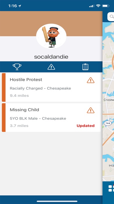
Expedited Response - GAMPS® provides an instant understanding of all resources and assets in the region. UAVs, Boats, Firefighters, Law Enforcement, HazMat Teams. Any resource can be located, deployed, and updated within seconds.
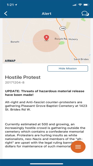
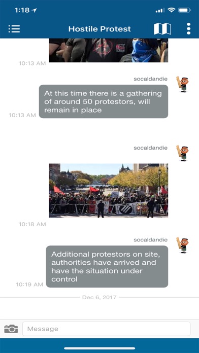
Comprehensive C4I - Ongoing mission status, live communications, and digital asset feeds, within one team or across multiple agencies ensures Command & Control is always in tune with the activities in the air, on the ground or in the water.
Improved Outcomes - The mission portals track planned, active, and complete mission areas. By leveraging this unparalleled situational awareness tool, response operations are completed quicker and more effectively.
Why GAMPS?
With existing systems, location and assignment of response assets are handled by individual groups and agencies. This limits global operations management and communications throughout the area of operations. Resource and asset assignment processes are ad-hoc and inefficient.
GAMPS® operationally manages UAVs and other response platforms among any number of groups. GAMPS® creates a common operating environment, and optimizes mission assignment, therefore improving efficiency, safety, and outcomes.
Unparalleled Situational Awareness - GAMPS® monitors the location of all reporting resources including UAV control stations (CS). Utilizing dynamic geofencing, complex metadata filtering, and other data models, operators are assigned missions/tasks, provided with encrypted communication channels, and critical data is gathered for storage and analysis. The common operating environment streamlines airspace and ground management and deconfliction.